Mapping Company Puts High-Resolution Images of Israel Online
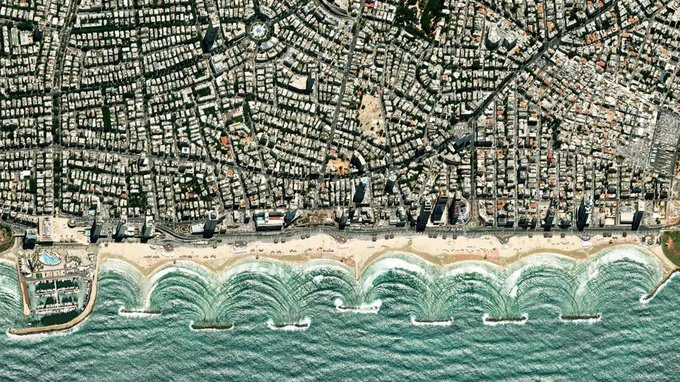
The private mapping company Mapbox announced this week that is offering the highest-ever resolution for images of Israel and the Palestinian territories. The company announced in a blogpost that it has quadrupled the resolution from 2 meters per pixel to 50 centimeters per pixel. In the past, the Kyl-Bingaman Amendment prohibited US companies from providing imagery of Israel and the Palestinian territories at resolutions greater than 2 meters per pixel. This law was changed in 2020, with the new restriction set at 40 centimeters. The blogpost points out that the new imagery “gives our customers the highest-resolution imagery available to plan a hike, check a delivery, or navigate between cities.” But Israel is likely more concerned about making publicly available online to just about anyone high-res images of the Dimona nuclear facility, army bases and the military’s headquarters in Tel Aviv, and Ben Gurion International Airport, to name a few perfect targets for terrorists.
This holiday season, give to:
Truth and understanding
The Media Line's intrepid correspondents are in Israel, Gaza, Lebanon, Syria and Pakistan providing first-person reporting.
They all said they cover it.
We see it.
We report with just one agenda: the truth.


